We start Mother’s Day Weekend with nice weather but it will come to an end by Sunday night.
Today: Mostly sunny, with a high near 76. Calm wind becoming southwest around 5 mph in the morning.
Tonight: Mostly clear, with a low around 53. Calm wind becoming south around 5 mph after midnight.
Sunday: Sunny, with a high near 81. South wind 5 to 15 mph.
Rain returns Sunday night as a complex system stalls out over the southeast keeping us in a wet pattern all the way through Thursday. The WPC is concerned about flooding across the south.
For now, confidence remains low with severe weather this time. However, there are a few scenarios that could produce a few strong to marginally severe storms.
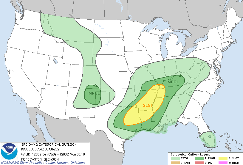
Mother’s Day Sunday 
Monday
Monday: Showers and possibly a thunderstorm. High near 74. Southwest wind around 5 mph. Chance of precipitation is 80%.
Monday Night: Showers and possibly a thunderstorm before 8pm, then a chance of showers and thunderstorms after 8pm. Low around 56. Chance of precipitation is 80%.
Tuesday: A 50 percent chance of showers and thunderstorms. Mostly cloudy, with a high near 72.
Tuesday Night: A 50 percent chance of showers and thunderstorms. Mostly cloudy, with a low around 53.
Wednesday: A 50 percent chance of showers and thunderstorms. Mostly cloudy, with a high near 68.
Wednesday Night: A 50 percent chance of showers and thunderstorms. Mostly cloudy, with a low around 52.
Thursday: A 50 percent chance of showers and thunderstorms. Partly sunny, with a high near 69.
Thursday Night: A 40 percent chance of showers and thunderstorms. Partly cloudy, with a low around 50.
Friday: Sunny, with a high near 74.