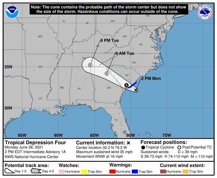
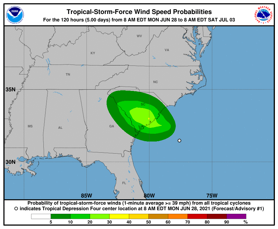
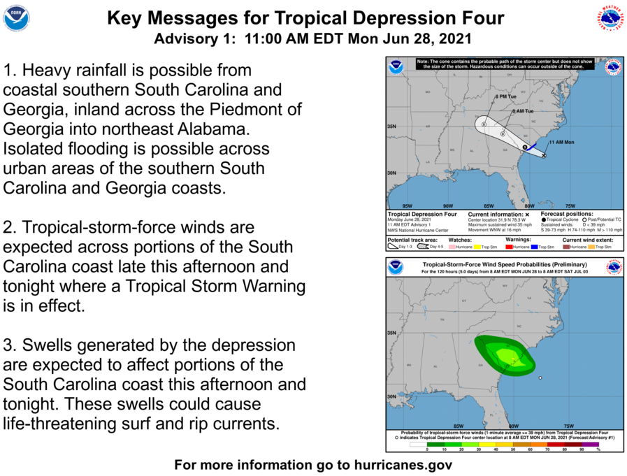
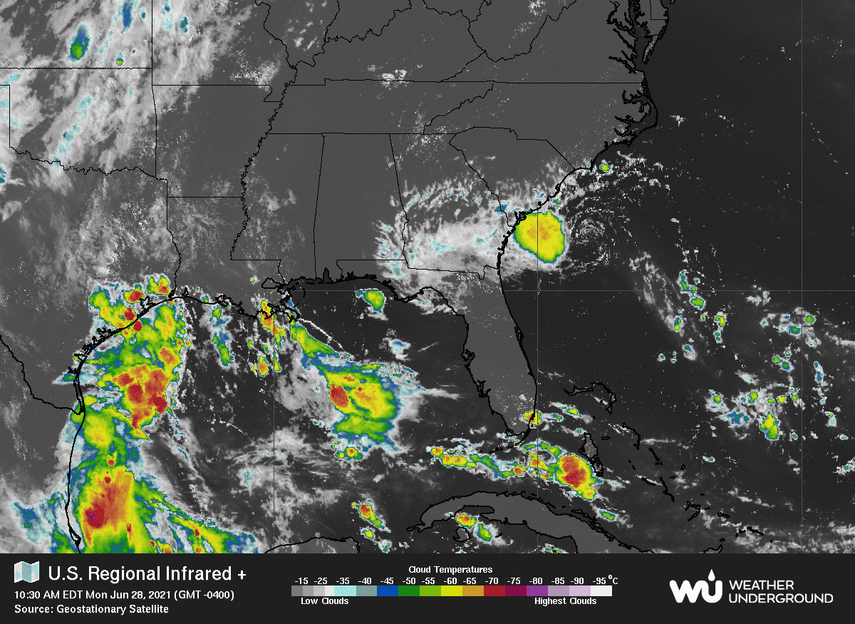
Tropical Depression #4 has formed in the Atlantic and will make landfall along the South Carolina coast late this afternoon or this evening. The storm will continue to the northwest crossing middle and north Georgia before moving into northeast Alabama by tomorrow afternoon. The main threat from this storm will be rain with isolated flooding. Be Weather Aware for the next 24 hours and download Dr. Don’s Weather App.
From the NHC: At 200 PM EDT (1800 UTC), the center of Tropical Depression Four was
located near latitude 32.2 North, longitude 79.3 West. The
depression is moving toward the west-northwest near 16 mph (26 km/h)
and this general motion is expected to continue for the next couple
of days.  On the forecast track, the center of the tropical cyclone
should make landfall along coast of South Carolina within the
warning area later this evening.

Maximum sustained winds are near 35 mph (55 km/h) with higher gusts.
Some slight strengthening is expected today, and the depression is
forecast to become a tropical storm before it makes landfall.  Rapid
weakening is forecast after landfall occurs. An Air Force Reserve
reconnaissance aircraft is currently investigating the cyclone.

The estimated minimum central pressure is 1013 mb (29.92 inches).