Weather Pattern Change?
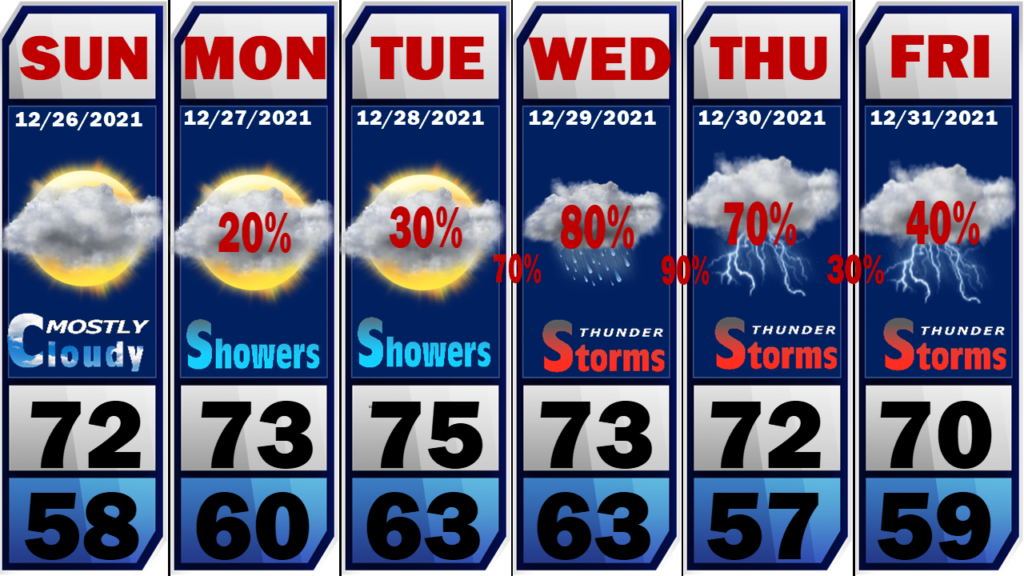
The unusually warm weather will continue through the last week in 2021 but there are indications things may change as we enter 2022. Record highs are being shattered all across the southeastern U.S. with daytime highs reaching the upper 70’s. This pattern will continue through New Years Day. Moisture levels are also on the rise […]
Very Mild Christmas Day
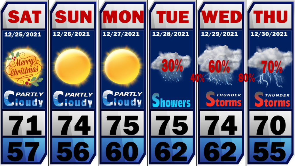
MERRY CHRISTMAS Short-sleeve shirts, shorts, and flip-flops will be in order today as we will come close to breaking records for the warmest Christmas day. We start the day cloudy but will gradually clear out by this afternoon. A rogue shower cant be completely ruled out but the chance is so small I’m not including […]
Warm and Mild Christmas
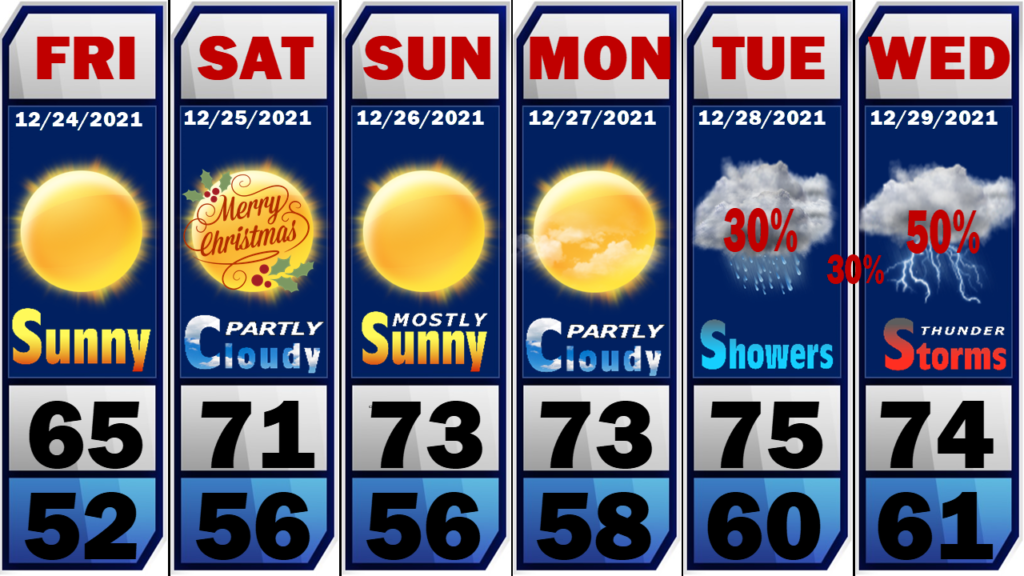
Today: Sunny, with a high near 63. Southwest wind 5 to 10 mph. Tonight: Increasing clouds, with a low around 52. Southwest wind 5 to 10 mph, with gusts as high as 20 mph. Christmas Day: Mostly cloudy, with a high near 69. Southwest wind 10 to 15 mph. Saturday Night: Partly cloudy, with a low around 56. Southwest […]
Back to Spring For Christmas
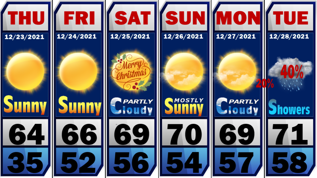
Say goodbye to seasonal temps until next year. A significant warming trend will begin today and continue well into the first week of 2022. Daytime highs will be in the low to mid 60’s today and Christmas Eve with low to mid 70’s Christmas Day and beyond. We will remain dry for Christmas. Rain chances […]
Christmas Warmup
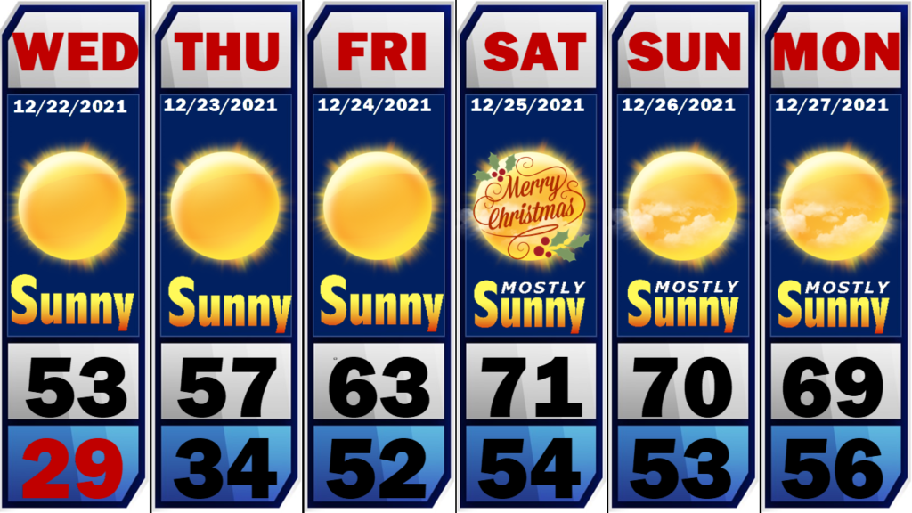
We start the day with Sunny and normal December temps as the low-pressure system that gave us the dreadful weather of yesterday moves off to the east and high pressure takes control of our weather. The first half of Christmas week will be seasonal with daytime highs in the mid to upper 50’s and overnight […]
Tornado Watch
The Storm Prediction Center is not extending the tornado watch east as of this time. SPC is noting unstable air across east Alabama and will monitor for any uptick with storm cells along the line as it moves into the area after 12:noon today. Remain Weather Aware this afternoon! We will be back will another […]
Tornado Watch Canceled
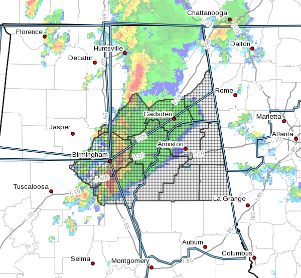
The Tornado Watch for east Alabama has been canceled. The threat for severe weather has subsided this evening. Showers and thunderstorms are still likely with heavy rain possible. A very serious situation in Birmingham as a Flood Emergency has been issued for the I-65 corridor between Birmingham and Pelham. Hoover has received around 7” of […]
Tornado Watch Continues Until 10:PM Central. Flash Flood Watch Until Tomorrow.
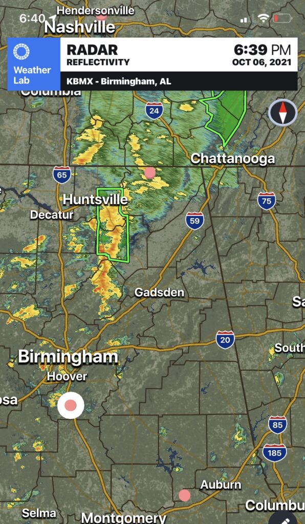
So far the strongest thunderstorms have remained in north central Alabama. Radar is relatively quiet at this time. I’m keeping a watch on things and will go live if conditions warrant.
Flash Flood Warning Chambers and Lee until 11:15
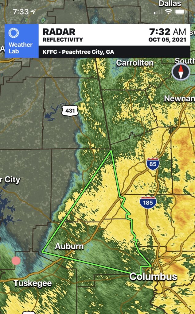
Serious situation in southeast Chambers and Lee Counties this morning. See below from the Chambers County EMA.
Flash Flood Warning
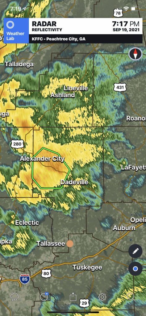
Flash Flood Warning for…Northwestern Tallapoosa County in east central Alabama…* Until 915 PM CDT.* At 608 PM CDT, Doppler radar indicated thunderstorms producingheavy rain across the warned area. Between 2 and 3 inches of rainhave fallen. The expected rainfall rate is 1 to 2 inches in 1hour. Additional rainfall amounts of 1 to 3 inches […]

