Coosa and Chilton County
SIGNIFICANT WEATHER ADVISORY FOR NORTHEASTERN CHILTON AND WESTCENTRAL COOSA COUNTIES UNTIL 730 PM CDT… At 659 PM CDT, Doppler radar was tracking a strong thunderstorm overMitchell Lake, or 7 miles northeast of Clanton. This storm was nearlystationary. Winds in excess of 40 mph will be possible with this storm. Locations impacted include…Clanton, Mitchell Lake, Gap […]
Elmore County
BULLETIN – IMMEDIATE BROADCAST REQUESTEDSevere Thunderstorm WarningNational Weather Service Birmingham AL638 PM CDT Wed Jun 30 2021 The National Weather Service in Birmingham has issued a * Severe Thunderstorm Warning for…Northeastern Elmore County in east central Alabama… * Until 730 PM CDT. * At 638 PM CDT, a severe thunderstorm was located over Eclectic, ornear […]
Tallapoosa and Elmore
SIGNIFICANT WEATHER ADVISORY FOR NORTHEASTERN ELMORE ANDSOUTHWESTERN TALLAPOOSA COUNTIES UNTIL 700 PM CDT… At 623 PM CDT, Doppler radar was tracking a strong thunderstorm overMartin Dam, or 8 miles north of Tallassee, moving west at 10 mph. Winds in excess of 40 mph will be possible with this storm. Locations impacted include…Eclectic, Southern Lake Martin, […]
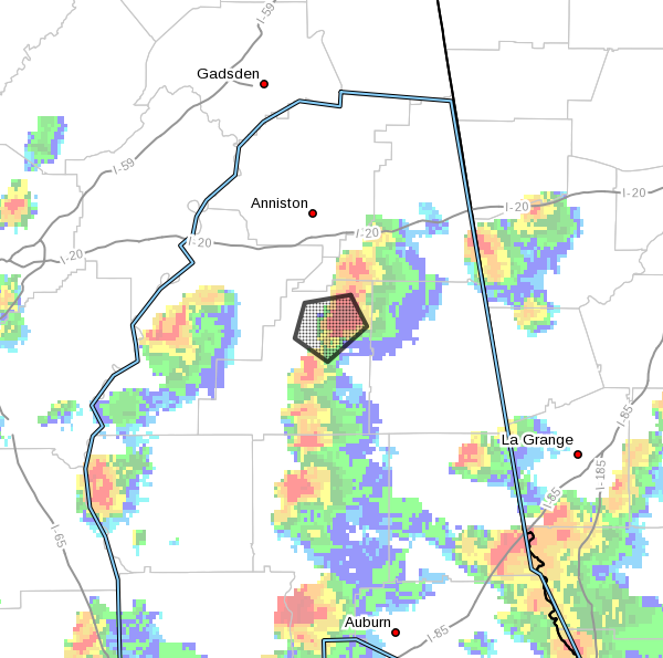
Clay County
SIGNIFICANT WEATHER ADVISORY FOR NORTHEASTERN CLAY COUNTY UNTIL645 PM CDT… At 618 PM CDT, Doppler radar was tracking a strong thunderstorm overBarfield, or near Lineville, moving southwest at 10 mph. Pea size hail and wind gusts up to 50 mph will be possible with thisstorm. Locations impacted include…Lineville and Barfield. PRECAUTIONARY/PREPAREDNESS ACTIONS… Frequent cloud to […]
Tropical Depression Four
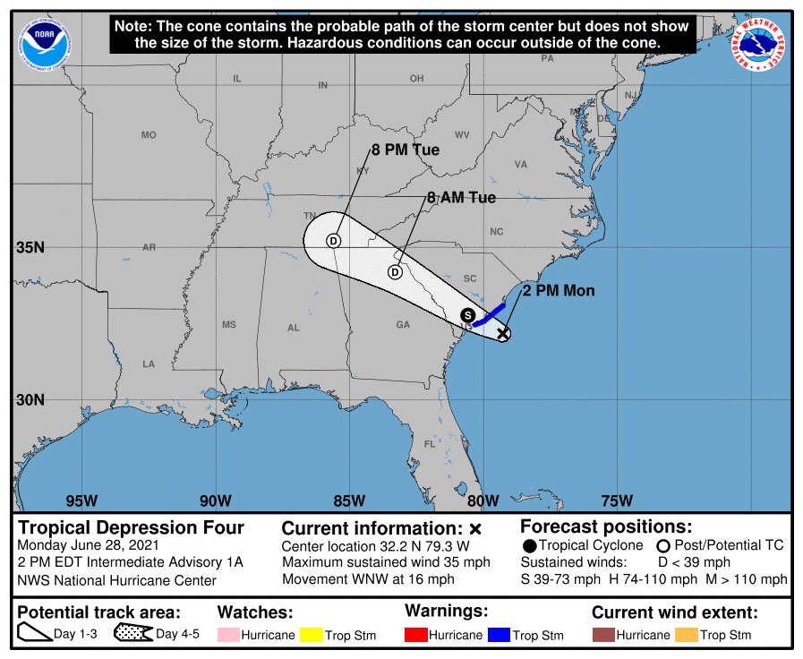
Tropical Depression #4 has formed in the Atlantic and will make landfall along the South Carolina coast late this afternoon or this evening. The storm will continue to the northwest crossing middle and north Georgia before moving into northeast Alabama by tomorrow afternoon. The main threat from this storm will be rain with isolated flooding. […]
Lee and Chambers County
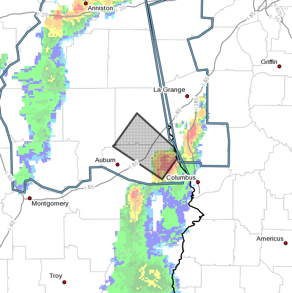
SIGNIFICANT WEATHER ADVISORY FOR NORTHEASTERN LEE AND SOUTHWESTERNCHAMBERS COUNTIES UNTIL 815 PM CDT… At 733 PM CDT, Doppler radar was tracking a strong thunderstorm nearBeans Mill, or 8 miles east of Opelika, moving northwest at 30 mph. Wind gusts around 40 mph will be possible with this storm. Locations impacted include…Auburn, Opelika, Lafayette, La Fayette, […]
Thunderstorms Devloping
Strong storms are developing this afternoon. Gusty winds, heavy rain and dangerous lightning can be expected. Storms are slowly moving east.
Rain Returns This Afternoon
Showers and thunderstorms will move into east Alabama this afternoon ahead of a cold front that will keep us wet through tomorrow. Wednesday we will go back to a scattered afternoon showers and thunderstorms with partly sunny skies through the weekend. Today: A slight chance of showers, then showers and thunderstorms likely after 10am. Mostly cloudy, […]
Tornado Watch Lee County
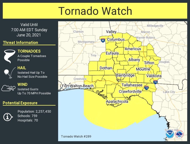
A new tornado watch has been issued for southeast Alabama. The watch is in effect until 6:am Sunday morning but will likely be canceled well before that time.
Multi Car Accident

From ABC3340: A multi car accident has I-65 near Greenville Alabama closed this afternoon. Photo from Chris Horn.