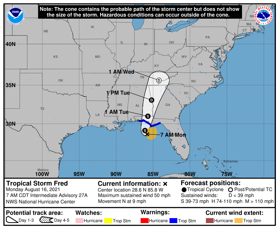
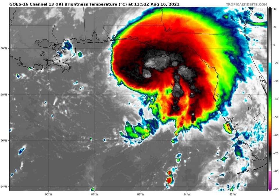
At 7:AM this morning Fred was located about 90 miles ssw of Apalachicola moving north at 9 mph. Maximum sustained winds of 50 mph. Fred appears to be forming an eye wall. On this track, Fred will make landfall near or just west of Panama City later this afternoon or early this evening. If you are in northwest Florida, follow local Emergency Management guidance.

Showers and thunderstorms will increase across east Alabama and west Georgia this afternoon with the main window for rain and thunderstorms coming after midnight tonight and continuing through noon tomorrow.

2”-4” of rain, gusty winds 15-25 mph and a isolated tornado is possible. A Flash Flood Watch is in effect through Tuesday for the entire area. A Tornado Watch has been issued for southeastern Alabama, southwest Georgia and portions of the Florida Panhandle.

Remain Weather Aware this afternoon through Tuesday. I will have today’s PrimeTime Forecast posted soon and I will go live this afternoon on Dr. Don’s Weather.