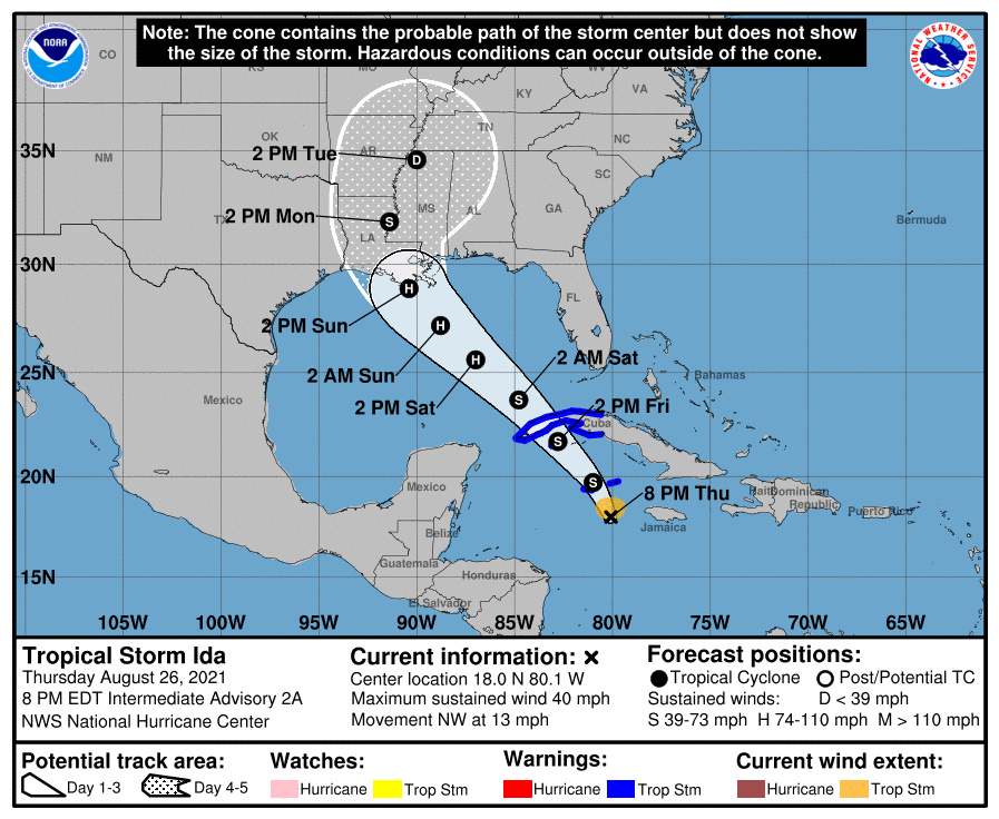
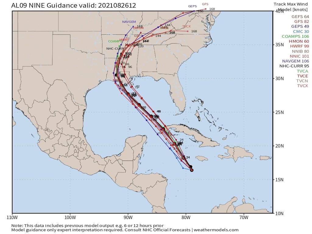
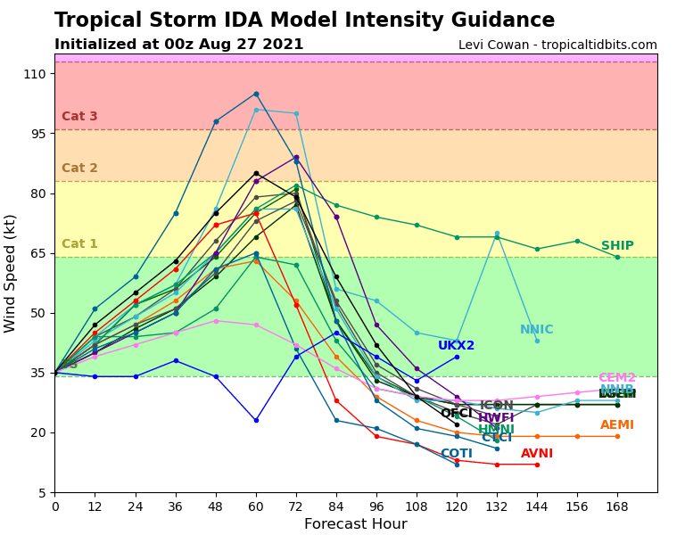
Tropical Storm Ida was born with the 5:pm update this afternoon and is headed for the Northern Gulf Coast. On her current track, she is expected to strengthen considerably over the weekend and make landfall along the central Lousiana coast Monday, possibly as a CAT 3 Hurricane.
Even though landfall will be west of Alabama, Ida may drag severe weather across Alabama and Georgia starting as early as late Sunday and continuing through Wednesday.
The storm is expected to make landfall south of New Orleans then track north, northeast through western Mississippi. Ida should then turn northeast to east through southern Tennessee keeping Alabama and Georgia on the “Dirty Side” of the storm. While I don’t expect hurricane or tropical storm conditions across the Dr. Don Coverage area, strong to severe thunderstorms and quick spin-up tornadoes will likely be possible Sunday night through Tuesday or Wednesday.
I will have the latest with a full Ida update on tomorrow morning’s PrimeTime Forecast. If this trend continues, I will go live tomorrow afternoon, before High School Football starts, with a special update.


