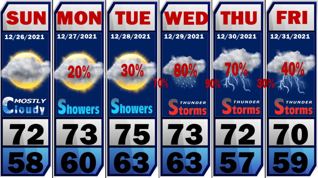
The unusually warm weather will continue through the last week in 2021 but there are indications things may change as we enter 2022.
Record highs are being shattered all across the southeastern U.S. with daytime highs reaching the upper 70’s. This pattern will continue through New Years Day. Moisture levels are also on the rise and we will likely see showers and thunderstorms by Wednesday. As a mater of a fact, we could see a passing shower tomorrow with better chances of storms Wednesday through New Years Day. We will also have to watch for a few strong to severe storms along the way.
There are signs in the long-range data that we could be looking at a significant weather pattern shift as we start the first full week of January 2022. Much colder weather and even a hint at frozen precipitation. You know that verbiage will be followed by my disclaimer! That’s way out in Never-never land so don’t bank on it! However, sooner or later, the cold air to our north has to move. That’s a fact.
If this shift to much colder weather verifies, we will also have to monitor the possibility of significant severe weather over the weekend or first part of next week. Stay tuned!


