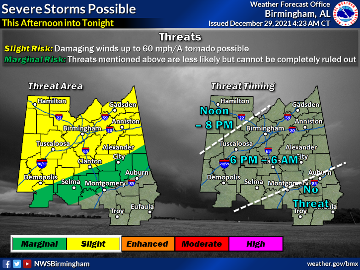
Another spring like and windy day for east Alabama and west Georgia with plenty of clouds and a shower or thunderstorm mainly this morning. We should see a lull in the action this afternoon and then another line of storms will move in this evening. This is where we need to pay attention for the possibility of a few strong to marginally severe storms. The line will be weakening as it moves into east Alabama so I’m not expecting a widespread outbreak of severe weather.
Another severe weather threat looks likely late Friday night into New Year’s Day and then much colder Sunday into the middle of next week. See the weather graphic below.
Snow or No Snow? I know you are wondering my thoughts on snow Sunday night so here goes. Overall, no snow! This is a classic set up where the moisture is long gone before it gets cold enough to snow. Computer models are just not capable of handling this type setup in the southeast. We know this. I just don’t understand the longtime TV meteorologist throwing this stuff out there when then are smarter and much more qualified than I. I will never tease you like this. Is there a chance? Certainly, but its too small to mention and it would not amount to very much at all. We need a big low in the Gulf of Mexico and cold temps to get a good snow in the south. This is not that type setup.
Im traveling back to the mountain from Birmingham this morning and will be in the studio this afternoon and tonight in the event we have severe weather issues I will go live. Tough day at Protective Stadium for my Auburn Tigers. We will be back! War Eagle!